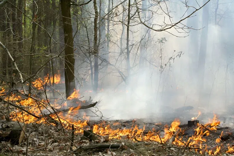
Manitoba Wildfire Service is advising the province continues at a high and very high fire danger and is cancelling all burn permits for the Burning Permit Area, with no new burn permits issued until the wildfire situation improves.
Manitoba is under a provincial state of emergency, under the Emergency Measures Act due to a wildfire season that is now the worst on record in the last 30 years, with more than one million hectares (ha) of area burned in the province. The state of emergency is in effect until August 9 and if necessary, may be extended.
The Government of Canada and the Canadian Armed Forces are working to support the evacuation of Kistiganwacheeng (Garden Hill First Nation). Evacuation efforts are continuing with multiple agencies participating.
In response to the need for shelter for wildfire evacuees, the government of Manitoba is working to open congregate shelters in Winnipeg and Portage La Prairie. In addition, the government of Manitoba and the Canadian Red Cross will start the set up of a congregate shelter at the RBC Convention Centre on July 13.
Manitoba Parks advises Bird Lake Campground in Nopiming Provincial Park has re-opened. Tulabi Falls Campground remains closed until Aug. 4 for clean up from the wildfire. Provincial Road 314 remains closed and all water routes and hiking trails are closed in Nopiming. For updates visit www.manitobaparks.com.
Manitoba Wildfire Service reminds Manitobans to be responsible and to keep fire prevention in mind as human activity continues to contribute to the province’s wildfires.
In addition to the cancellation of fire permits in the Burning Permit Area, travel permits are required within active fire boundaries. To view active fire boundary maps, visit: www.gov.mb.ca/conservation_fire/Fire-Maps/fireview/fireview_map.html. To apply for a travel permit, contact a Natural Resources and Indigenous Futures district office and visit: www.gov.mb.ca/nrnd/co/index.html to find a location.
Fires of note
The Manitoba Wildfire Service continues to respond to 107 active wildfires across the province, a total of 270 wildfires to date, well above the average for this date of 201 total fires.
Fires of note include:
East region:
- Fire EA061 remains out of control at approximately 237,200 ha. A closure and mandatory evacuation order continues for parts of Nopiming Provincial Park and the entire areas of Wallace Lake and South Atikaki provincial parks. PR 314 remains closed through Nopiming Provincial Park, as well as PR 304 east of Bissett. The southern portion of Atikaki Provincial Park is also closed, including the Bloodvein and Gammon river corridors and Aikens Lake.
West region:
- Fire WE017, located near Sherridon and the city of Flin Flon, is approximately 370,780 ha and is out of control. For the safety of personnel, boaters are asked to avoid waterways being utilized by Manitoba Wildfire Service tankers and aircraft.
- Fire WE025, located near Mathias Colomb Cree Nation (Pukatawagan), is approximately 59,220 ha and is being monitored. The fire is contained around the community but a mandatory evacuation order continues.
- Fire WE028, located 10 kilometres (km) from Bakers Narrows Provincial Park, is approximately 7,190 ha and is out of control.
- Fire WE052, located 20 km from Snow Lake, is approximately 3,000 ha and is out of control. A mandatory evacuation order is in place for the town of Snow Lake. Wekusko Falls Provincial Park is closed due to wildfires. A mandatory evacuation order is in effect for park users.
- Fire WE053, located 16 km from Snow Lake, is approximately 7,445 ha and is out of control.
North region:
- Fire NO002, located near the town of Lynn Lake, is approximately 80,120 ha and is out of control.
- Fire NO042, located 14 km southwest from the town of Lynn Lake, is approximately 9,525 ha and is out of control. A mandatory evacuation order is in place for the town of Lynn Lake and Marcel Columb First Nation.
- Fire NO005 located near Pimicikamak Cree Nation (Cross Lake), the Incorporated Community of Cross Lake, Jenpeg Generating Station and Whiskey Jack Landing, is approximately 84,375 ha and is out of control.
- Fire NO010, located near Tataskweyak Cree Nation (Split Lake), is approximately 22,275 ha and is out of control. A mandatory evacuation order remains in place for Tataskweyak Cree Nation (Split Lake).
- Fire NO026, located 14 km from the town of Leaf Rapids, is approximately 6,820 ha and is out of control. A mandatory evacuation order is in place for the town of Leaf Rapids.
- Fire NO047, located 26 km from the town of Leaf Rapids, is approximately 7,015 ha and is out of control. A mandatory evacuation remains in place for the town of Leaf Rapids. Wildfire smoke may impact PR 391.
- Fire NO061, located 14 km from the city of Thompson, is approximately 16,370 ha and is out of control.
- Fire NO076, located seven km from Wabowden, is approximately 44 ha and is out of control.
- Fire NO079 located near Kistiganwacheeng (Garden Hill First Nation), is approximately 2,500 ha and is out of control. A mandatory evacuation order is in effect for issued for Kistiganwacheeng (Garden Hill First Nation). Evacuations are ongoing.